This week's project consisted of using our constructed GCP's and getting used to different UAS platforms at the community garden which is located near the South Middle School here in Eau Claire. First we took out 9 of the GCP's that were constructed and placed them in a grid pattern inside the garden area. We then used the Total Station to get accurate GPS points as shown in figure 1. This is done by placing the Total Station directly in the middle of a GCP and obtain a level position for best accuracy of the GPS point.

Figure 1. Setting up the GCP and placing the correct GPS coordinates in the center of the GCP with the Total Station.

Figure 2. Phantom 3 Advanced going through the preflight checklist before take-off.
The last flight conducted used the DJI Inspire which was also a multi-rotor that was slightly larger than the phantom 3 advanced. This flight did not have a mission plan to it as this platform was only used for the students to get an idea of how the platform performs. This included rotating, throttle up/down, and turning the platform. It was very smooth in its motions and seemed like it would be very hard to crash.

Figure 3. DJI Inspire assembled and ready for a preflight check.
Results

Figure 4. Oblique image of flight 1 processed data with GCP's calibrated to the images.
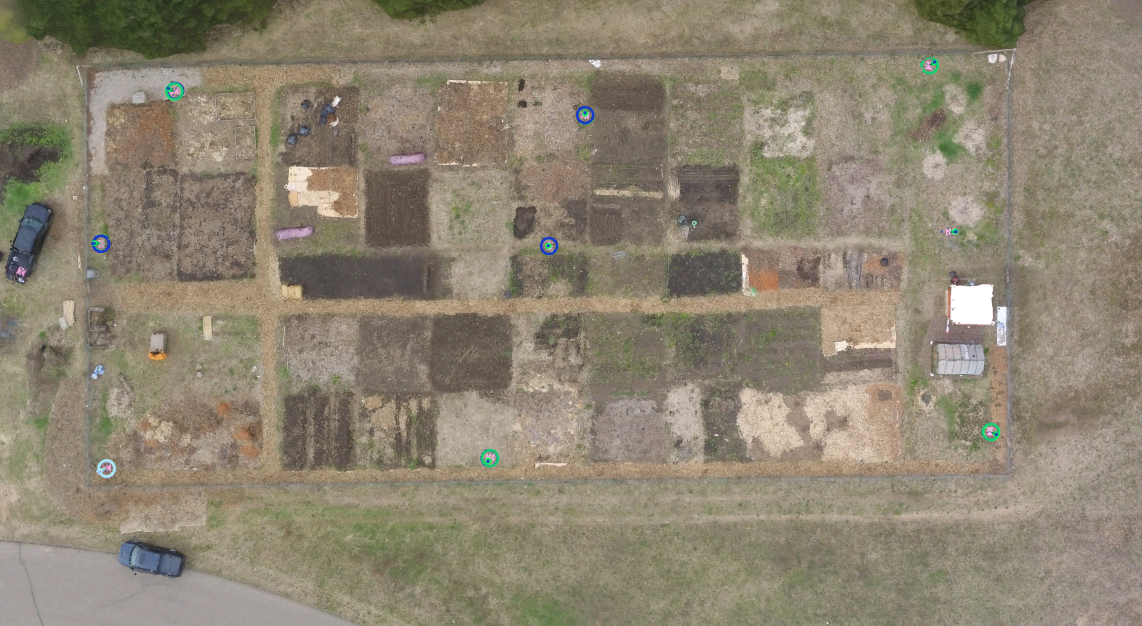
Figure 5. Plan view of flight 1 processed data.

Figure 6. Processed oblique imagery of vehicles during flight 2 with the angled camera and 3D modeling used in Pix4D.
No comments:
Post a Comment